There are many maps included in sections of this
website that are brought together here for your convenience.
In addition, links to useful map sources are included.
Massachusetts History and Geography:
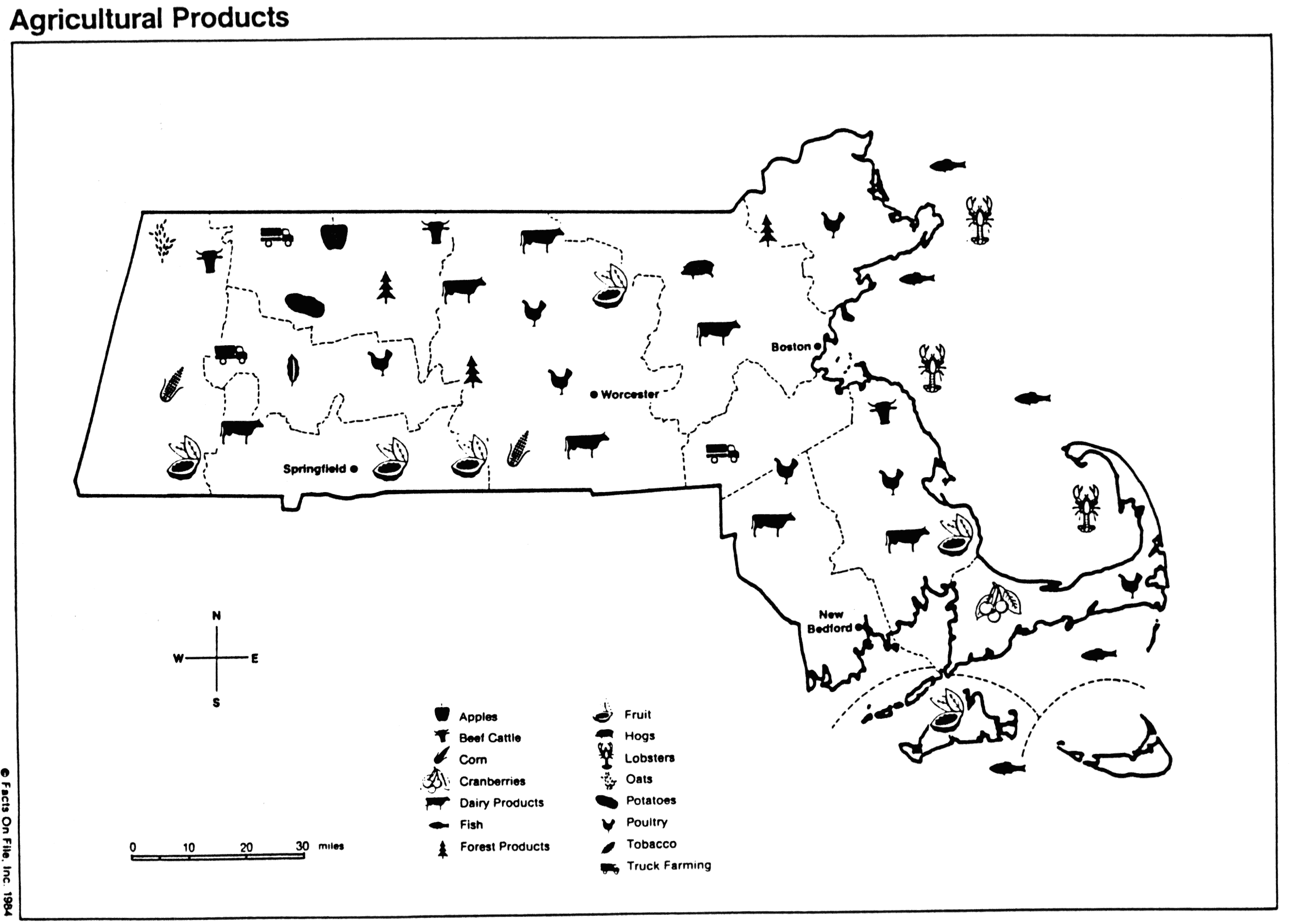
Agriculture
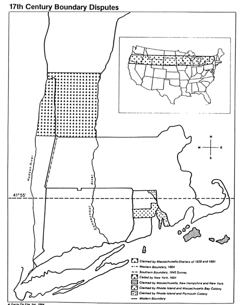
Boundary Dispute
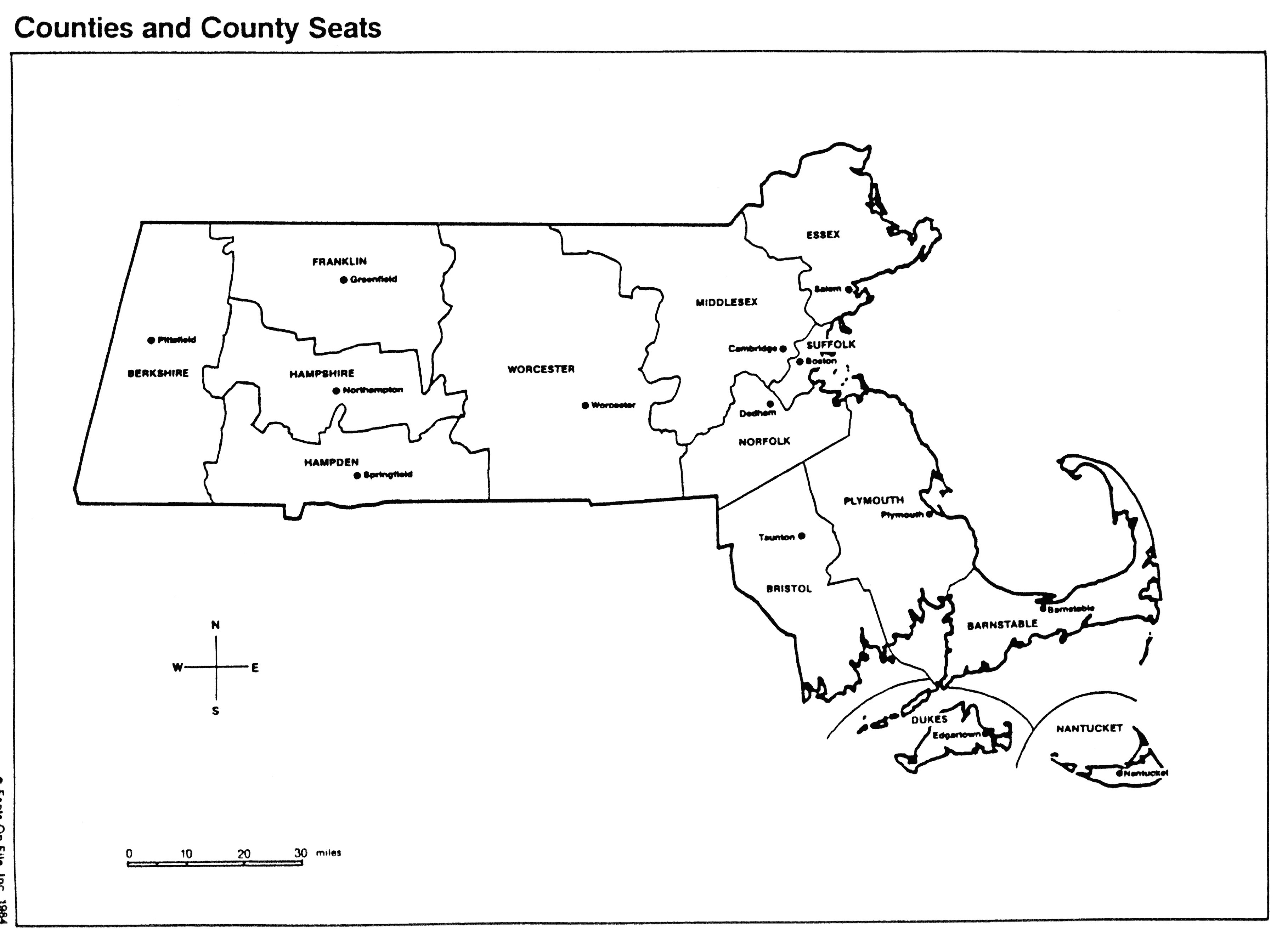
Counties
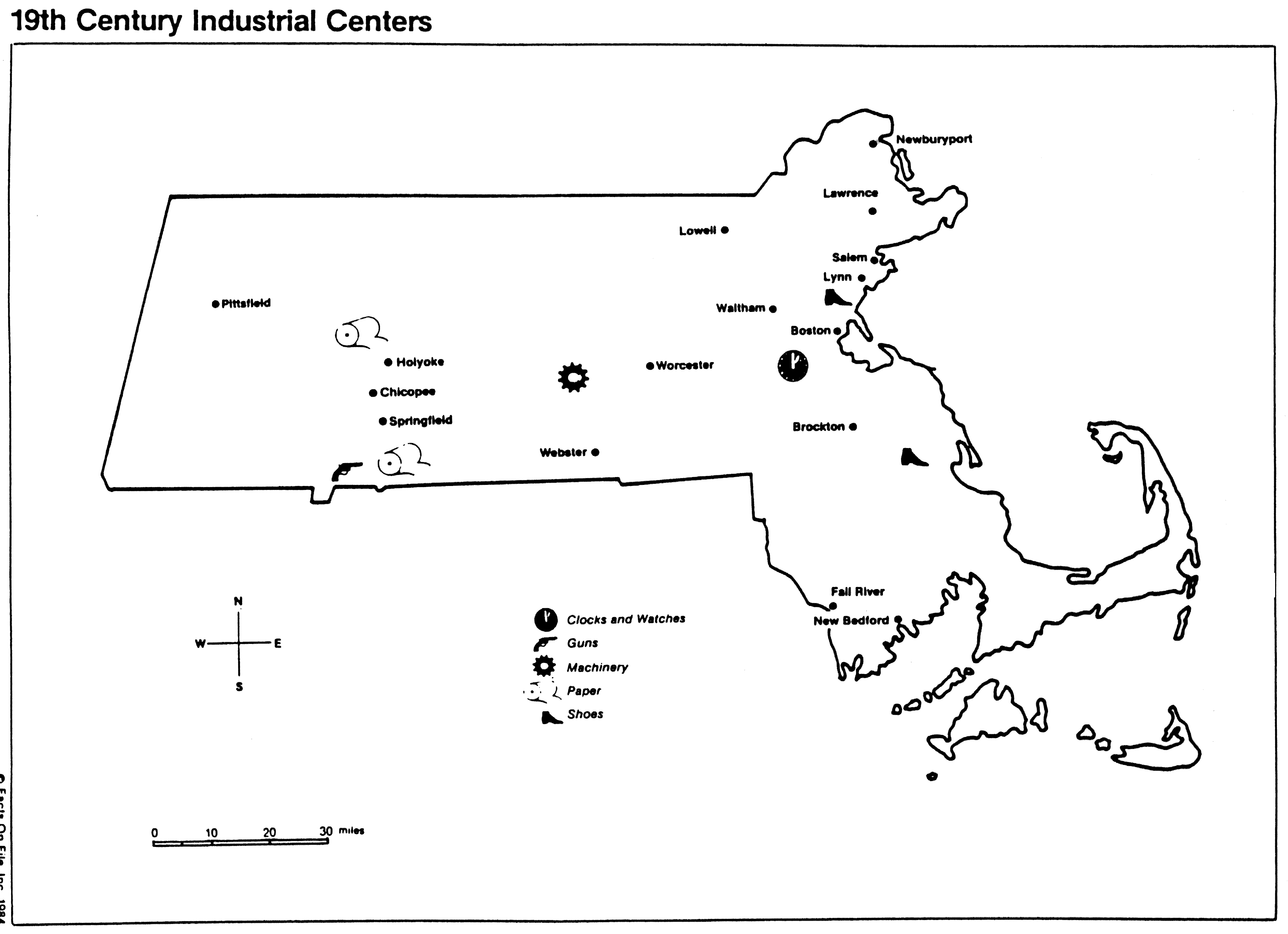
Industrial Centers
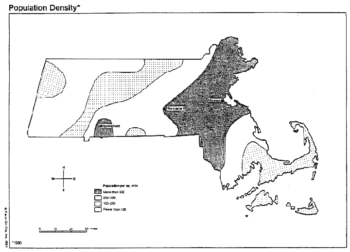
Populations
Topography
Watersheds & Water Systems:
Boston Harbor Watershed
(Neponset, Mystic, Charles Rivers)
Mass.
River Basins
Nashua Watershed
Riverways
map and list of river organizations
SuAsCo
Watershed (Sudbury, Assabet, Concord Rivers)
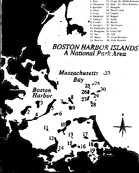
Boston Harbor & Islands:
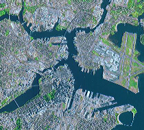
Boston
Harbor image by air
Island names
Landsat image
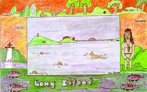
Long Island drawing
Local Studies:
1614,
John Smith map of New England coast
1832 map
of Belvidere Village, Lowell
1852
map of Boston
1877
map of Fall River
USGS
Historic Maps of Massachusetts towns from topographic
quadrangle maps, through University of N.H. Dimond Library
Additional Map/Image Links:
American
Memory Project, Library of Congress, search
for Massachusetts maps in the historic collections.
ESRI GIS
(Geographric Information System), Internet-based site
locator application
Map
Center: Boston's cartographic history and topographical
development through maps from the Norman B. Leventhal
Collection at the Boston Public Library
Massachusetts
Electronic Atlas, Harvard University 250 data
layers about the state.
MassGIS
Many geographic and environmental applications for planning,
education.
MIT/Ortho,
a collaboration between MIT and MassGIS featuring
digital orthophoto maps of Boston
National
Geographic Society Map Machine
Office of Coast Survey, copper plate engraving technology
of 19th and 20th c. nautical maps of Mass. Bay coast.
Space and Defense maps, satellite imagery:
NASA;
National Imagery
and Mapping Agency (Defense).
US Geological Survey:
information by state and by topic (see index). Check
out
Find
A Map under education.
Woods Hole
Oceanographic, North East Science Center historic
photo collection1870's to present on NOAA website.
Books:
Historical
Atlas of Massachusetts
