Amherst College
This is the Department of Geology's web site for their Geology 12: Principles
of Environmental Science course. It contains some valuable historic maps of
Boston Harbor.
Boston
Harbor Watershed Map
This excellent color watershed map includes Neponset, Mystic and
Charles watersheds.
Boston Light photos:
Part of a lighthouse site out of the University of Tennessee; four
good photos of Boston Light with descriptions of this historic
landmark.
Fort Warren
This photo is part of a site which includes information compiled by Edward Rowe
Snow on Fort Warren during the Civil War.
Library
of Congress, American Memory Project
This site features useful historical maps of Boston Harbor as part of
the Library of Congress's American Memory Project.
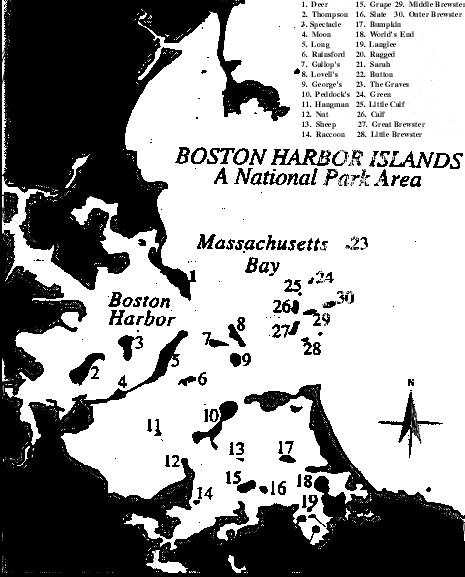
Map of the Boston Harbor Islands
This map identifies the islands by name.
MIT/Ortho:
This site, a collaboration between MIT and MassGIS, presents aerial
orthophotos of the Boston area. Point to the Boston Harbor area you
wish to view and click.
NOAA Photo Library Collection:
See Coastline Collection for historic images of MA coastline,
including Boston Harbor views of East Boston, South Boston and
Charlestown. See restrictions re credits.