Massachusetts
Studies Project
Teaching Tools for Local History
** MAPS **
 Introduction:
A map is a visual representation of a place on a flat surface. Maps
can help us understand our community's location in space and time. In
addition to teaching geographic understanding, maps can: illustrate change
over time, personalize history by giving evidence of familiar landmarks
in the setting of the past, and by demonstrating the attitudes of people
and their beliefs about the area they live in, as well as the political
policies of past eras. Exploring and creating maps can hone students' abilities
to analyze, think and learn.
Introduction:
A map is a visual representation of a place on a flat surface. Maps
can help us understand our community's location in space and time. In
addition to teaching geographic understanding, maps can: illustrate change
over time, personalize history by giving evidence of familiar landmarks
in the setting of the past, and by demonstrating the attitudes of people
and their beliefs about the area they live in, as well as the political
policies of past eras. Exploring and creating maps can hone students' abilities
to analyze, think and learn.
Maps have traditionally been limited to paper media, which could be difficult to obtain for local areas. Digital solutions provide a range of new choices for searching, manipulating, viewing and analyzing maps, although paper maps can still be used very effectively in the classroom when available.
General Teaching Tips: In general, try to select maps which are not too complicated, or noisy for students to comfortably explore. Experiment with map websites and CD-ROMs before students use them to be sure you are familiar with navigating, zooming in and out, saving and printing maps. Some map sites require special browser plugins, for instance the "MrSid" plugin for Library of Congress maps, to make best use of their maps.
Most maps have a title, which often includes information about the time period that the map illustrates. Maps have orientation, which includes compass direction and geographic relationships within an established area. Maps have a source, or author, which often gives insight about its intended purpose and reason for creation. Maps may have a legend explaining the symbols used and a scale showing how distance is represented. Many maps use grids to show lines of latitude and longitude. (Adapted from: Library of Congress "Zoom Into Maps")
Types of Maps: (Adapted From National Geographic Xpeditions):
- Political maps represent the political units of the world, showing names of localities and boundary lines.
- Physical maps use shaded or painted relief to illustrate a region's major landforms, including mountain ranges, deserts, glaciers, rivers, valleys, etc.
- Topographic maps are general reference maps showing coastlines, cities, and rivers that use contour lines to show elevation differences. Such maps are helpful to hikers because they can show elevation changes along a trail.
- Atlas maps can show anything about anywhere. An atlas can contain collections of political, physical, satellite, and thematic maps. Countries, states, towns have produced atlases that describe all aspects of that locality.
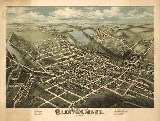
- Historical maps can be maps created in the past, reproductions of past maps, or modern-day creations illustrating past events or places.
Basic Questions
- What is the title/subject of this map?
- Who was the cartographer (creator)? What do you know about this cartographer/creator?
- When was it prepared? If no date is listed, what clues are there that could help date the map?
- Where was this map originally produced and where is the map now found? (owner, repository)
- What was the purpose of the map and its intended audience?
- What tools were used to prepare it and what is its appearance? (Black and white, hand drawn with pen etc, or printed in colors, etc., type of paper or print?)
- Describe what you find on this map: specific information and symbols.
Critical Thinking Questions
- How can you tell if this map is accurate? What sources would you use to verify it?
- What do you think was the intent of the map creator and why it was written? What is stressed and what is omitted? Do you think any bias was shown in its creation?
- What additional information is needed to help you understand the map information more fully?
- What questions would you like to address to the creator of this map?
- What would you like to learn more about to better understand the context of this map and how would you get this information?
- Compare maps of town in past and present. Draw a map illustrating the town in the future. Use a Venn Diagram to explore similarities and differences between the three illustrations. What things remained the same? What things changed? What things do people have control over (e.g., transportation, housing style), and what things cannot be easily changed, barring unforeseen technological breakthroughs (e.g., climate, soil, natural resources)? How realistic do you think your future map is?
Worksheets (attached)
- "Thinking About Maps" - graphic organizer for analysis and note taking.
- "Map Analysis Worksheet" US National Archives and Records Administration
- Outline map of Massachusetts
- Outline map of Massachusetts with some
cities and towns.
Resources and Websites
Books:
- Mapmaking with Children: Sense of Place Education for the Elementary Years Heinemann, 1998 by David Sobel
- Place-Based Education: Connecting Classrooms & Communities by David Sobel
- Historical Atlas of Massachusetts by Richard W. Wilkie and Jack Tager. University of Massachusetts Press, 1991.
Websites:
- "National
Geographic Map Machine" Easy search engine; includes distance measuring
tool; multiple map types for a given town.
- "Xpeditions Atlas: Maps made for Printing and Copying". Includes outline maps of Massachusetts, blank and with cities and towns.
- "Zoom
Into Maps: Hometown, USA: Local Geography" Library of Congress Teaching
Feature. See also
LOC Map Collections, which includes many local maps of Massachusetts
towns and cities.
- "Maps
over Time" Wonderful overlay maps comparing past, present and future
of localities over time. Creator Bill Warner seeks to develop online
overlay maps for many towns in Massachusetts.
- "TerraServer" Topographical and aerial photograph maps of the United States provided by the US Geological Survey., searchable by town.
- "Maptech" - searchable topographical maps and nautical charts. Fewer aerial photos available than at TerraServer, but the topo maps are clearer.
- 1895 US Atlas State Map, County Maps, Index of Towns & Cities in Massachusetts
- Massachusetts Archives, State Archives Building
- Massachusetts Town Maps, 1794, 1830 series (not online).
Model Lesson Plans
- "Your Changing Town" Students explore the reasons why cities change over time and investigate how their own town has changed over time.
- "Getting to Know Your City: An Introduction to Map Skills". Wisconsin Historical Society
- "Old Map, New Map: Let's Compare" Wisconsin Historical Society
- "Using Your Community as a Learning Resource" Intro to maps for young students
- "Historical Maps" Youth Source: Youth and Heritage Learning Source
Other: Some Massachusetts Maps for the Classroom (Powerpoint File with outline, topographical and political maps of Massachusetts.)
Commercial Sources for Reproductions of Historic Local Maps
- Old Maps: Town maps are available for specific counties
- Historic Maps: CD-ROM disc reproductions of circa 1860 maps of Massachusetts towns.
- Old Maps: More maps of Massachusetts
- BEERS County Atlas: CD Collection of Massachusetts 1870 - 1876
This
resource book was developed with support from
The Massachusetts Historical Records Advisory Board, Office of the Secretary
of the State
and
The Massachusetts Foundation for the Humanities